|
| |||||||||||||||
|
| |||||||||||||||
|
March 2010
Heading Home
Turks and Caicos, Bahamas
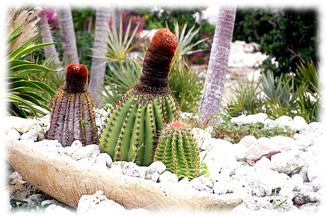
The Grand Turk (most believe the island is named after the indigenous cactus that resembles the Turkish fez).
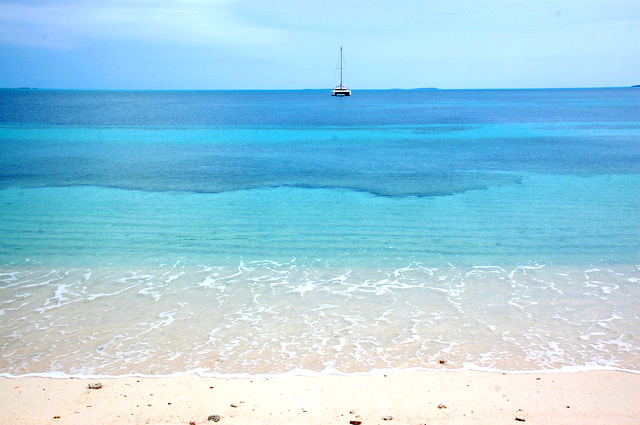
After saying goodby to Tom and Amy, we departed St John on a cloudy Friday morning under brisk winds and a rolling sea. Three days later we arrived at Grand Turk Island the very same place that the "old redhead" Christopher Columbus landed on 12 October 1492. Or is it? You see the exact location of Columbus first land fall in the "new world" is somewhat in dispute. Most believe that Guanahani, the name Columbus gave to the island where he first landed, is San Salvador in the Bahamas but a growing number of people (mostly from the Turks and Caicos) believe that the Grand Turk Island more aptly fits Columbus' description of his first landfall. Today the island has a number of signs on the island which actually fix the spot where Columbus came ashore. In the absence of facts, signs just might enhance tourism.
But hey, The Grand Turk is filled with landings. In 1962 John Glenn landed back on terra firma on Grand Turk after his famous orbit of the earth. In fact LBJ flew down here to meet him.
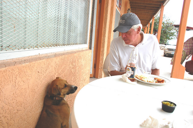
We anchored where we believed the Customs House to be but nothing was moving on shore and we couldn't spot a flag at customs and then we realized it was Sunday. Although there were no signs of life, the beach was neatly lined with lounge chairs and dinghies and moored inside the anchorage were a dozen or so dive boats. After untangling the 100 foot rope that had attached itself to our running gear during our sail, we moved Shiraz to an anchorage with greater protection from the northwest winds since the forecast called for a cold front to move through the islands in the next few days. That night we slept soundly after the three day voyage.
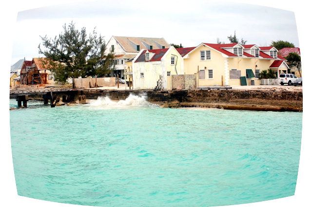
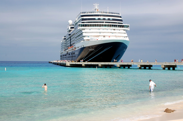
The next morning another landfall. A Holland America Lines cruise ship towered over the landscape of the low lying island. We made our way by dinghy to a dock nearby the cruise ship and entered the shopping center where the passengers had disembarked. This Potemkin Village was actually a mall. Outside the gates were 30 or so taxi's waiting to take passengers that escaped to the main part of the real town. Since we were unable to find anyone who knew where Customs was located we took the dinghy three miles north into town and stopped at the Government House thinking this the most logical location for Customs or information as to its location. No Luck. So we shrugged our shoulders and found a place for lunch and eventually made our way back to the boat.
By mid afternoon the cruise ship had departed and wild donkeys roamed the beach in front of our boat. The donkeys are descendants of the beast of burden used by the companies that harvested salt from the flats back in the 1800's. At sundown a small heard of black and white cattle combed the beach for edible seaweed. Life on the island was returning to normal.
Next morning and another landfall, two more cruise ships were tucked in for the day.
Cacios (The word caya hico in Lucayan means "string of islands")
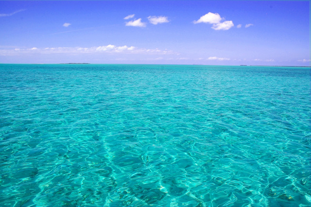
We decided to cross the Caicos Bank rather than sail north around the islands. Why, I don't know. The route across the bank in beautiful clear water is littered with coral heads and for over half the journey we were running in 8ft of water or less. Since we draw 4.5 feet it was an anxious 8 hours. Finally we anchored at Sapodilla Bay and there we cleared customs and immigration.
Bahamas
The weather was right so we struck out for a three day sail to the Abacos near the northern tip of the Bahama chain. During the three day passage along the east coast of the Bahamas we passed near San Salvador the island where many believe Columbus first made landfall in the "new world". (okay just one more reference about Columbus) Although the island contains Lucayan artifacts that have been carbon dates back to the 15th century there i
Back to the "reality show". The cold front came through 12 hours before predicted and we had to motor against 20+ knot winds in order to make a day light landing at Little Harbor, 20 miles south of our original destination. The popular north end of the Bahamas is unexplored territory for us and we planned to keep it that way however the weather didn't cooperate.
We thought we would "yellow flag" the Bahamas which means that we would anchor for bad weather or a rest stop but not go ashore and not check in. Instead we were caught in a parade of northerlies that kept us in the Abacos for more that a week. From our first anchorage in Little Harbor we moved to Marsh Harbor where we got the feel of this "skinny water" community of sailors and marinas. Despite the need to tip toe around the banks and sand bars that make up a great deal of the Abacos, the boating community is vibrant. There are of course many weekenders, winter cruisers and transit boats with a high component of Canadians. Everything seems to be well organized and the radio chatter tells you that this is a very social community. With hurricane season just a few months off, people are already preparing to put their boats up or head north for the summer.
And we are off
While listening to Herb Hilgenberg, Southbound II Weather Net-SSB, we heard a boat ask for weather to make a passage from the Abacos to Beaufort NC. Well, that was close enough to our destination in South Port NC so we hooked up with S/V Lis Tigre' for the passage. The direct route to North Carolina is only mildly effected by the trade winds and if there isn't a strong northerly coming down the winds are typically light and variable. After a good start with 20 knot winds a large stationary high set in, the first of the season. So without wind, we started burning our $4.37 per gallon diesel and for the next 72 hours we motored at around 5 knots. This passage sets a record for the most continuous hours of motoring and the fewest (0) fish caught. There are quite a few "different" jelly fish floating on the water, almost look like plastic bags. We don't know the proper name yet but will definitely look it up once we have access to the internet. We have also had a display of beautiful sunrises and sunsets for our trip home.
|